Filters
You are in
Maps
/
Tsunamis in Japan
Find tsunami sites in Japan on this map: location and details for each place.
Each card has the type (2011, Sanriku, Nankai, or other), the date, the damage, one fact, address, and official site.
Rikuzentakata, Hirogawa, Okushiri. Tsunamis.
Search this map
Type
All types
2011 Sanriku Nankai Other
Sort
Map order
Name A–Z
16 listed
2011
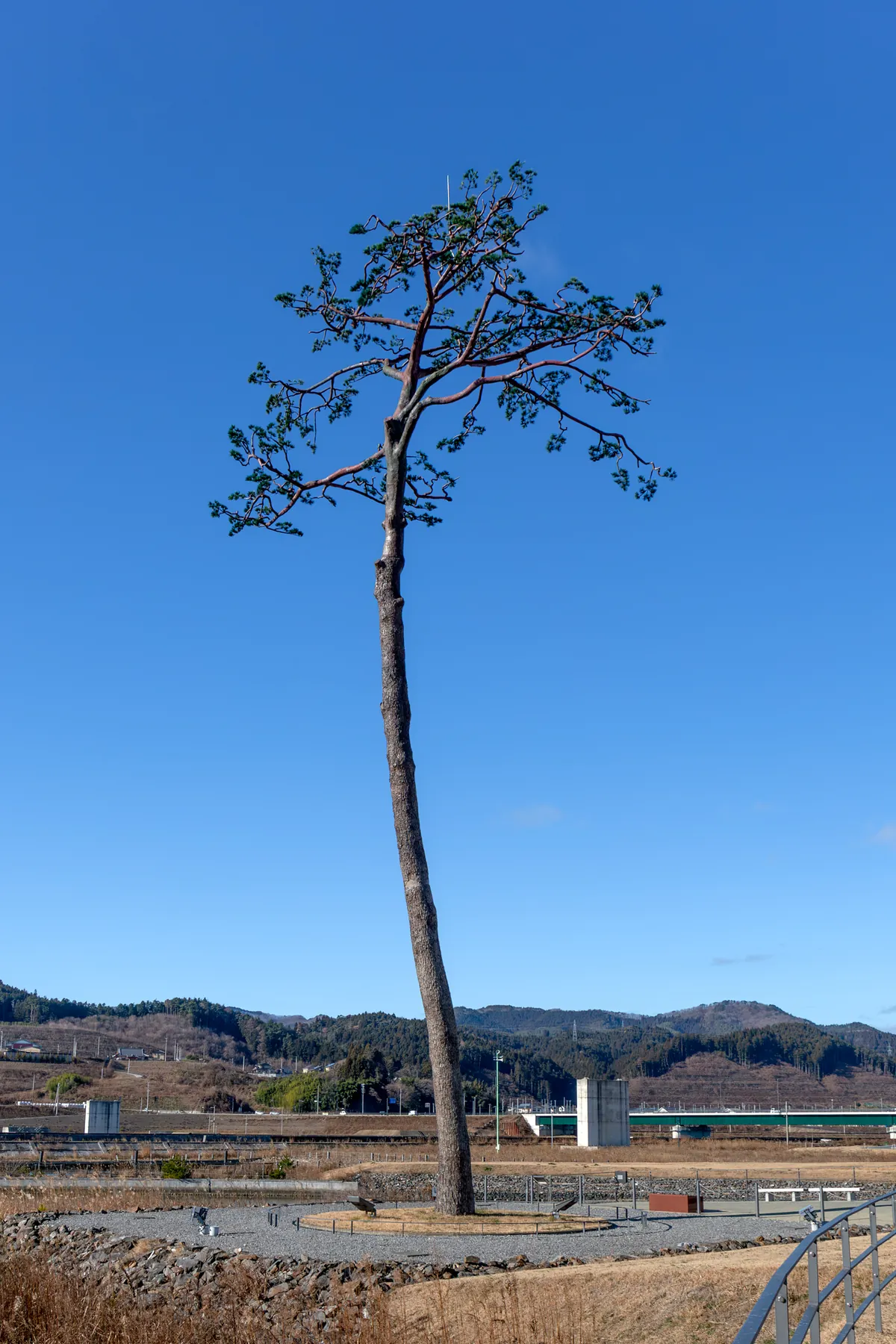
Takata Matsubara
Save to trip
Type: 2011
Year: 11 March 2011
Damage: about 70,000 pines fell; downtown Rikuzentakata was swept away
Tree: one pine remained; it died in 2012; the trunk is kept
Address: 岩手県陸前高田市気仙町
Minamisanriku
Save to trip
Type: 2011
Year: 11 March 2011
Damage: the wave overtopped the three-storey building; Shizugawa was swept away
Hall: the steel frame of the disaster-prevention office still stands
Address: 宮城県本吉郡南三陸町志津川字汐見町
Ishinomaki Minamihama
Save to trip
Type: 2011
Year: 11 March 2011
Damage: the Minamihama neighborhood was wiped out
Park: the memorial meadow covers the old streets
Address: 宮城県石巻市南浜町
Kesennuma
Save to trip
Type: 2011
Year: 11 March 2011
Damage: water reached the fourth floor of the old Koyo school
School: the former fisheries high school is now the memorial hall
Address: 宮城県気仙沼市波路上瀬向
Taro
Save to trip
Type: 2011
Year: 11 March 2011 (also 1896 and 1933)
Damage: the ~10 m wall, once called the world’s highest, was overtopped
Wall: Tarō’s X-shaped seawall; the lower town flooded
Address: 岩手県宮古市田老
Okawa Elementary
Save to trip
Type: 2011
Year: 11 March 2011
Damage: 74 pupils and 10 staff died
School: the wave ran up the Kitakami to the school, about 4 km from the sea
Address: 宮城県石巻市釜谷
Arahama Elementary
Save to trip
Type: 2011
Year: 11 March 2011
Damage: the village on Sendai’s beach was swept away
School: about 320 people reached the roof and lived; the building still stands
Address: 宮城県仙台市若林区荒浜
Yuriage
Save to trip
Type: 2011
Year: 11 March 2011
Damage: Yuriage’s harbor and streets were wiped out
Hall: Natori’s hall tells 11 March
Address: 宮城県名取市閖上西
Iwanuma
Save to trip
Type: 2011
Year: 11 March 2011
Damage: the coastal plain flooded several kilometres inland
Hill: six hills built from the debris
Address: 宮城県岩沼市押分
Onagawa
Save to trip
Type: 2011
Stone: Yes
Year: 11 March 2011
Damage: the town center was destroyed; the wave rose above 15 m
Stone: いのちの石碑 marks a height that held
Address: 宮城県牡鹿郡女川町女川浜
Sanriku
Aneyoshi
Save to trip
Type: Sanriku
Stone: Yes
Year: 15 June 1896 (the stone also names 1933)
Damage: the lower hamlet was swept in the Meiji tsunami; in 2011 the wave stopped near the stone
Stone: do not build houses below this stone
Address: 岩手県宮古市姉吉
Nankai
Hirogawa
Save to trip
Type: Nankai
Year: 24 December 1854 (Ansei Nankai)
Damage: Hiro flooded; Hamaguchi Goryo set rice sheaves alight to guide the flight
Wall: a ~5 m, 600 m dike built afterward; it held in 1946
Address: 和歌山県有田郡広川町広
Other
Okushiri
Save to trip
Type: Other
Year: 12 July 1993
Damage: Aonae was destroyed; fire followed the wave; run-up reached about 30 m on the island
Hall: the tsunami hall in Aonae
Address: 北海道奥尻郡奥尻町字青苗349-1
Ishigaki
Save to trip
Type: Other
Stone: Yes
Year: 24 April 1771 (Meiwa 8)
Damage: the wave swept Ishigaki and the Yaeyama islands
Stone: the Meiwa cenotaph in Ōhama
Address: 沖縄県石垣市大浜
Uki
Save to trip
Type: Other
Stone: Yes
Year: 21 May 1792 (Unzen)
Damage: Mayuyama collapsed; the Ariake tsunami reached Higo
Stone: the warning stones in Uki
Address: 熊本県宇城市
Shimabara
Save to trip
Type: Other
Year: 21 May 1792
Damage: Mayuyama collapsed; the city and the Higo coast took the tsunami
Tower: the memorial pagoda on Ichibangai
Address: 長崎県島原市一番町
There are no pins in this slice yet.
There are 16 places. 2011 has 10. Other has 4. Stone has 4. Nankai has 1. 4 places sit in more than one category. The highest count in one prefecture is 8, in Miyagi. The places sit in 7 prefectures.
By category The same places, split by category.
2011 has 10. Other has 4. Stone has 4. Nankai has 1.
4 places sit in more than one category.
By category By category Places Percentage 2011 10 62.5% Other 4 25.0% Stone 4 25.0% Nankai 1 6.2% Sanriku 1 6.2%
By prefecture The highest count in one prefecture is 8, in Miyagi. The places sit in 7 prefectures.
Prefectures with the most places Prefecture Places Percentage Miyagi 8 50.0% Iwate 3 18.8% Wakayama 1 6.2% Hokkaido 1 6.2% Okinawa 1 6.2% Kumamoto 1 6.2% Nagasaki 1 6.2%
By region The same places, added up by region.
Places by region Region Places Percentage Hokkaido 1 6.2% Tohoku 11 68.8% Kansai 1 6.2% Kyushu 2 12.5% Okinawa 1 6.2%
The data used in this study were set on 23 October 2026.
© 2026 Suki Desu. All rights reserved